
Whenever I spend a significant amount of time anywhere I search out local trails. I love spending time outdoors in nature and going for a run, hike or even a leisurely walk. It always grounds me and clears my head. Like my post about the Bray to Greystones trail in County Wicklow, Ireland, I will be writing about the various trails I encounter.
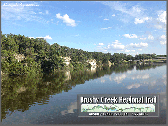
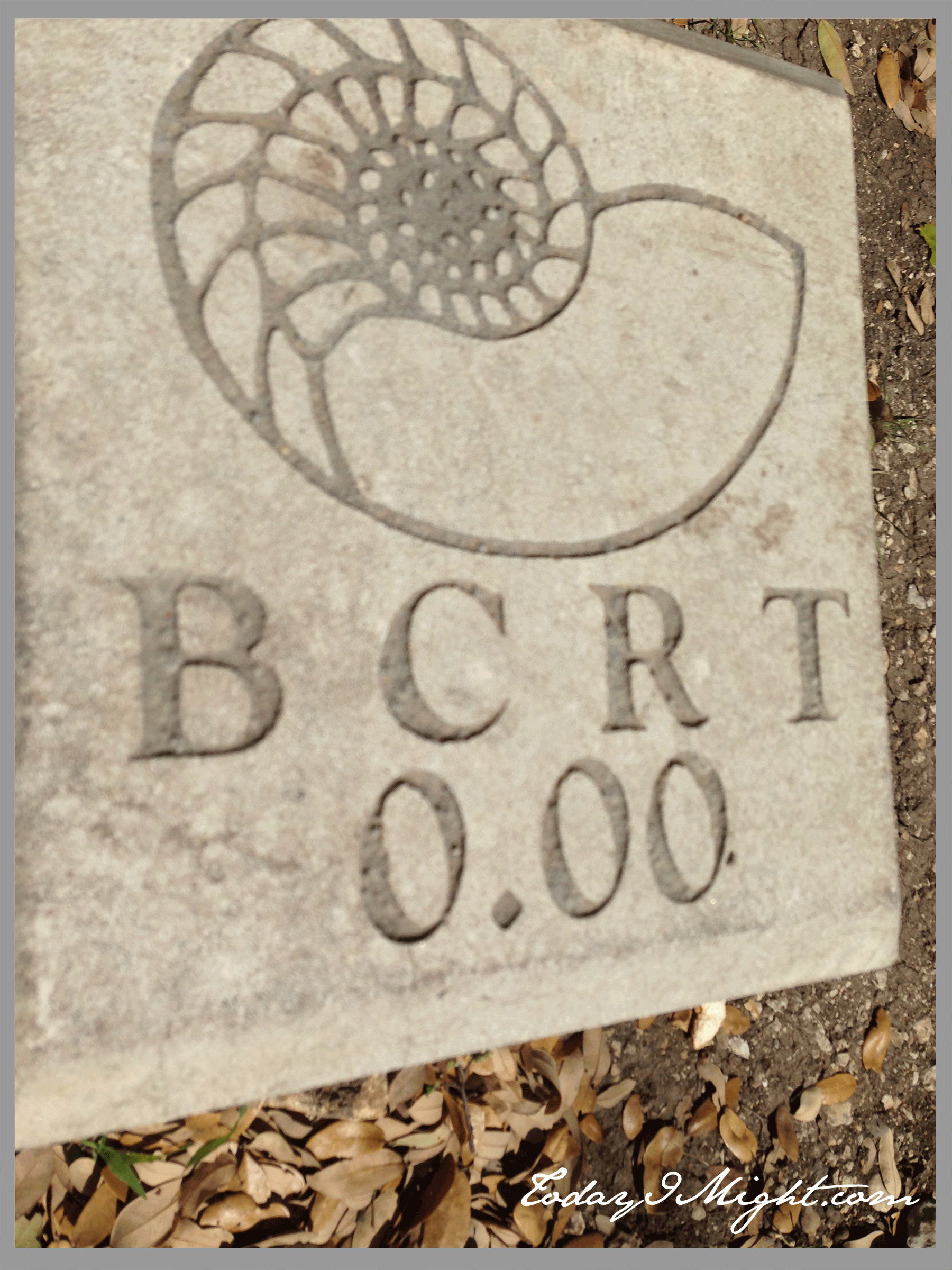 Right now I’d like to introduce you to my everyday “go-to” trail. The Brushy Creek Regional Trail which spans from Cedar Park, TX to North Austin. It’s an easy trail to traverse. At present, the trail spans 6.75 miles and I feel like I know every inch of it intimately. I always start my trail adventures at my end of the trail which starts at the YMCA Twin Lakes on Old Hwy 183 or S. Bell. Starting at the trail head 0.00 mile marker, the paved trail winds beside some woods and a small creek tributary. At about the 0.25 mile marker you’ll pass over a bridge that crosses a small waterfall where the lake spills out to Brushy Creek. I usually save visiting the waterfall for the return trip so my dog Sophie can take a dip to cool off at the end of our outing. Or, if she’s not with me, to do a mountain pose and breath in the negative ions. I’ve seen plenty of people spread out a blanket by the waterfall and chill out. I even saw an enterprising fella hang a hammock under the bridge to relax in. I was jealous… but I digress.
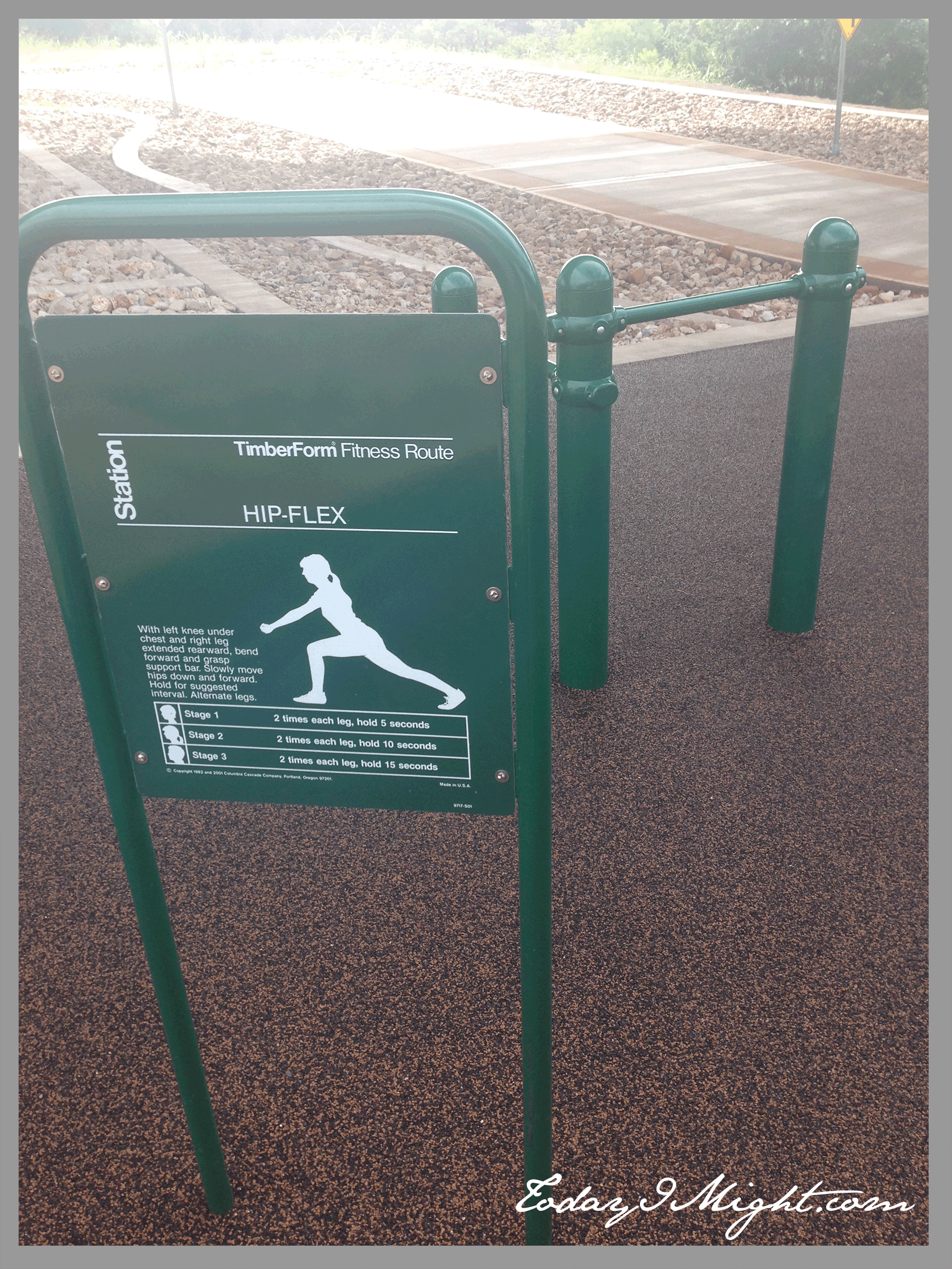
At the 0.50 mile marker you’ll find yourself at the 183 overpass – an alternate entrance to the trail, with parking. At this trail head there is some exercise equipment available to you on a padded surface.
Exercise Stations

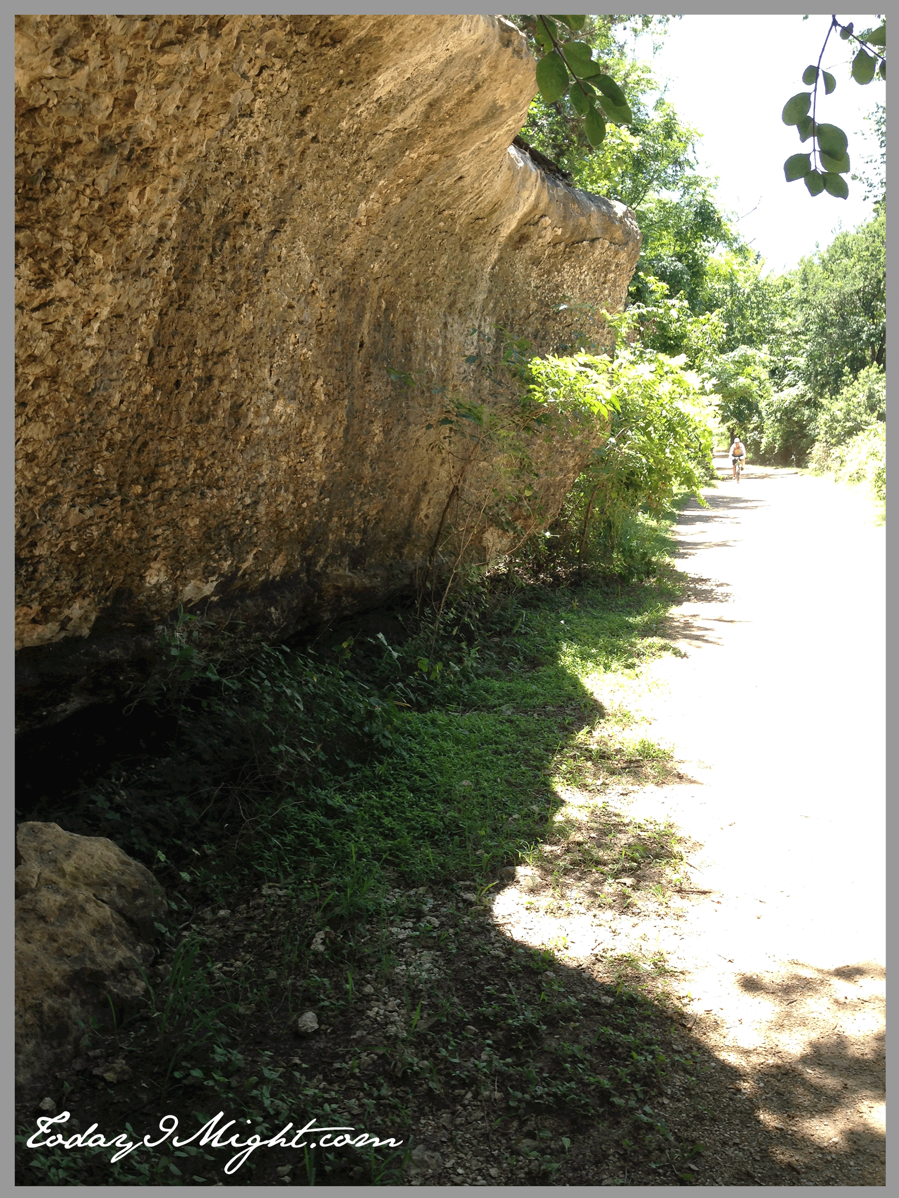
Over another small bridge, and it’s into the woods you go. The next .75 miles are wooded, with the creek flowing to your left and a limestone cliff to your right. It’s lovely and shaded here, which does a lot to keep you cool in the dead of a Texas summer. You likely won’t be on the trail for long before encountering others, be it dog walkers, bikers, runners, roller-bladers, or kiddos on push scooters. No ATVs or horseback riders allowed though. I can’t recall any incidences where my fellow trail users have not been courteous. Faster moving traffic almost always warns of their presence with a bell ring or “on your left” shout-out. If you’re looking for seclusion, this might not be the trail for you though.
There is another small waterfall off the cliff along this stretch, but it sometimes dries up if there hasn’t been rain in awhile.

Wildflowers
The next mile meanders between open fields and woods. In the spring when the wildflowers are in full bloom it’s a great place to get those iconic Texas bluebonnet pictures.

This was Sophie at the beginning of the bluebonnet season. Isn’t she cute? She’s a great trail mate, but she’s only good for about 4 miles in and out. She gets too excited by the squirrels and bunnies and people and literally overheats. Speaking of dogs, the number of dog stations along the trail are limited. You may be left holding the bag for a couple of miles, so to speak, depending on where your dog decides to relieve themselves. It’s evident that some people grow tired of this and end up leaving their bags of business on the side of the trail, which is disappointing. I won’t get on my soapbox now though. As for your own business, there are about 5 spots on the trail that have restroom facilities.
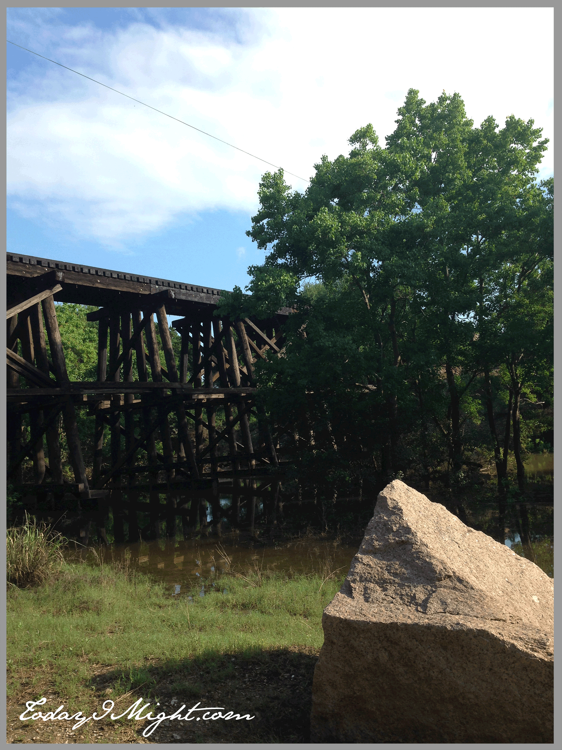
Train Trestle
Between mile markers 1.75 and 2.00 there is a cool old train trestle. The trestle dates back to the 1880s and there are placards explaining it’s history. It seems to be a popular area for photographers to bring families for professional pics. Formerly it was used to transport the pink granite that makes up the Texas State Capitol building. As you can see below, some pieces fell off during their journey. Glad I wasn’t jogging by that day…
Sports Park
Shortly after the train trestle, you’ll come upon the Brushy Creek Sports Fields. A good place to stop if you want to top up your water or use the facilities. The area has two baseball fields and three soccer fields, as well as a 15,000 square foot skate park. If I feel at all tired from the 2.25 mile jaunt to get to this part of the trail, I watch coaches put their athletes through their paces for a second and get over it.
About another mile down the trail you’ll arrive at the Brushy Creek Lake Park. Here you’ll find a picnic area, boat rentals, fishing docks and more. Some day soon I hope to paddle board on the lake here. Soon!
From here the trail crosses the Brushy Creek Dam and winds down hill to another stretch through the forest. And again, along this length there are more limestone cliffs looming over you to one side.
Then, the last couple of miles connect a series of parks with various neighborhood outlets, until you reach the end of the trail at 6.75 miles.
Multi-use Trail
I feel very fortunate to have this trail nearby. It is diverse and beautiful enough to run on every day. It’s also long enough for a decent bike ride. I hear it has a great mountain biking course with lots of twists and challenges that progress the further down the trail you go. When I’m ready to start training for my half-marathon, it’s a great distance to run in and out for my long runs. In general, it has a lot to offer outdoor enthusiasts of many kinds. If you’re in the neighborhood I highly recommend it. Otherwise, I hope you have an outdoor space near you that’s equally awesome. Happy trails!
